Another New Garmin Etrex
So my latest Garmin eTrex 10 broke in the same way the previous ones did: the rubber round the power button either degrades or gets thin and drops out. Then the side of the circuit board is exposed through the little hole it leaves, revealing a tiny push button that I then have to use my keys or the arms of my glasses or a pen to push to turn it on and off. This finally failed the other day and I could no longer turn it on.
Time for a new one I thought. We’ve been buying Garmin eTrex 10s since 2012. I wrote about them here, 13 years ago. They’ve been part of our daily lives and our long term project of capturing everywhere we go, every day since then.
Visiting the Garmin site, I realised the eTrex 10 had been discontinued and replaced with what they called an eTrex SE. This now seems to be Garmin’s entry level GPS model. After checking that it would mount as an external drive without the need to install funky proprietary software, I ordered one, which duly arrived.
Teething troubles
The USB interface on the eTrex SE is now USB C, so I plugged one in and nothing happened (on my laptop at least). I tried it on Soph’s Thinkpad Carbon X1 running Debian with Cinnamon desktop environment and it mounted as an MTP device. This was good, I thought. (I’ll eventually have to work out why this doesn’t work on my Thinkpad T470 with i3 as desktop environment).
I was faced with a list of files and folders which I didn’t recognise from the etrex 10. There seemed to be lots of ‘.fit’ files in dozens of different folders. I intuited that there might be some interest in the ‘Activities/Track Me’ folder. I’d had to set that in the GPS. I suppose it makes sense for Garmin to cater to users who want to track their different sports activities. This is clearly not our use case, so I thought ‘Track Me’ came closest. The ‘.fit’ files in this folder were indeed the ones that contain the tracks the device is recording.
A new file format
The fit files are a binary format but luckily there are some options.
GPSBabel reads them and can generate a
GPX file out of them but they come in as one long track / track
segment rather than being split up in the way that the eTrex 10 used
to do automatically when you plugged it in to a computer. You can get
GPSBabel to make new tracks every time it detects a gap of a certain
number of seconds between points. I favour 60 seconds for this. I also
like each track to be named after the timestamp of the first
trackpoint. The command for all this is
gpsbabel -t -i garmin_fit -f [path-to-fit-file.fit] -x
track,pack,split=60s,title="%Y-%m-%dT%H:%M:%S" -o gpx -F
[name-of-gpx-file-you-want-to-save.gpx]
The other option is to install the python package garmin-fit-sdk
with pip or your installer of choice and roll your own converter
script, which is what I did. There are a couple of details to deal
with. Garmin-fit-sdk brings in all timestamps as timezone aware (at
least that!) datetime objects, like datetime.datetime(2025, 10, 18,
16, 12, 35, tzinfo=datetime.timezone.utc) and you’ll need to write
that as the string "2025-10-18T16:12:35Z" in your GPX file. The
other is that the fit file (or you could say the Garmin) saves the
latitutde and longitude in a semicircle format, expressed as a nine
digit number. To convert this into degrees, you times it by 180 /
231. I’ve yet to see what happens to my script when the
longitude crosses the zero meridian and goes negative. Let’s hope it
copes, because having dyscalculia, I don’t have the maths to
troubleshoot it!
Preliminary Cons
I say ‘preliminary’ because it’s a little early to tell. It took years to develop the work flow with the eTrex 10s, involving an import script and preprocessing script before manual editing and finally importing into the sqlite database (with the Spatialite extension).
- No GPX file made
- New fit file format I have to re-write my importing process for
- No track segments
- No idea when I’m running out of memory
- Not sure whether leaving the GPS on but not moving (like when we’re in the garden, or working outside), keeps recording. This could be a deal breaker for us, because of our birch forest visualisations and carpets.
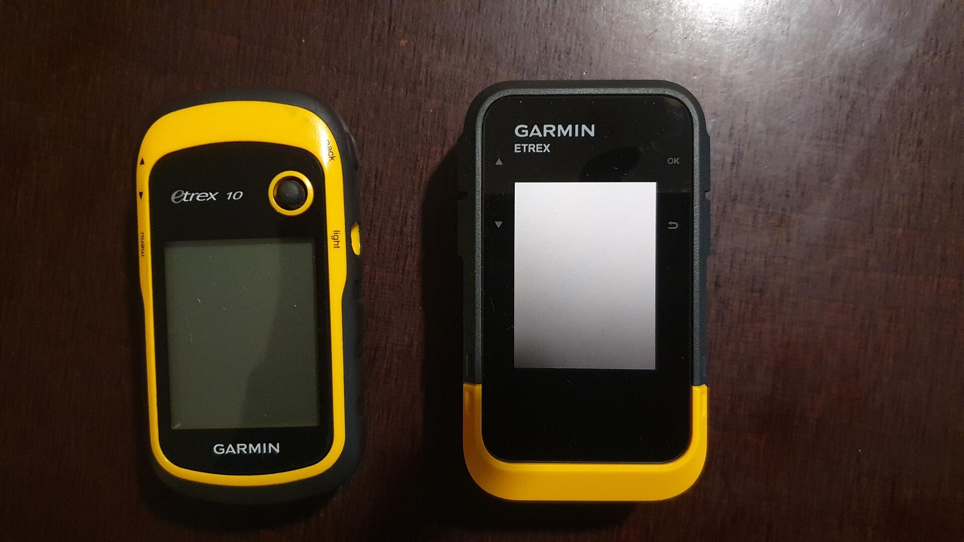
- As you can see in the photo, it’s bulkier. It’s not quite as thick as the eTrex 10 but it is taller and wider.
Preliminary Pros
- They are being produced, unlike eTrex 10s now.
- Battery life seems better.
- It is harder to make random waypoints (the prominent button on the front of the eTrex 10 used to be pressed in bags etc and result in random waypoints being generated).
Conclusion
I’m a little skeptical and the not recording while stationary might be a deal breaker, as I say, but I will give it a go and see if we can make it work. Otherwise, we’re in to hardware hacking to repair the old ones, finding old eTrex 10s on Ebay or Kleinanzeigen or building our own, which won’t be as durable.