Three years after having that initial conversation about our work with Peter at an openFrameworks workshop, he has opensourced the visualisation animation application on github here.

Narrating Our Lines installation at Art Laboratory Berlin photo: plan b
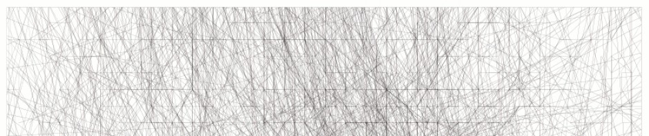
What started out as an application to simply animate our GPS tracks (as used by us in Narrating Our Lines) has turned into a multi-purpose programme, which we have also used in the pieces in which we re-trace our GPS tracks as well as in the participatory works we have made in Birmingham and Leuven, bringing together and visualising a large number of individuals’ GPS tracks.

Dan and Soph re-tracing their GPS tracks for the exhibition Tracing Mobility at the Haus der Kulturen der Welt in Berlin
Thank you Peter, thank you openFrameworks and while we’re at it, thank you Richard Stallman, Linus Torvalds, my Mum, my Dad, Soph, Ruby etc…

Screenshot from A Day in the Life, the Walkers of Birmingham, a Fierce festival and Midlands Art Centre commission, using Peter Vasil’s Openframeworks application
Thanks for posting!